Live location tracking
Use live location tracking to improve visibility, coordination and review within the relevant operation.
Solutions
Phone calls cannot provide reliable vehicle visibility. Omtrack GPS vehicle tracking Tanzania shows live locations, routes and alerts, helping owners protect vehicles and respond faster.
GPS vehicle tracking Tanzania
Visibility that supports action Mobile and desktop access • Local installation supportVehicles we support
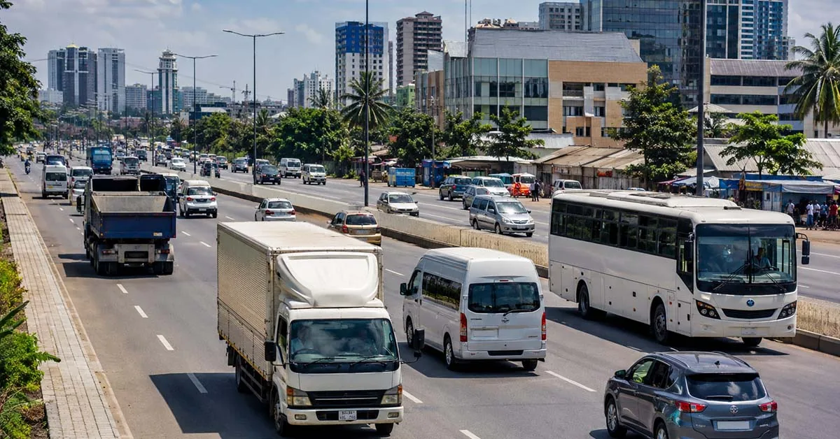
Omtrack GPS tracking works with a wide range of cars, buses, trucks and special-purpose vehicles from different brands.





Compatibility and available features depend on the vehicle model, tracking device and installation assessment.
A clearer operational view
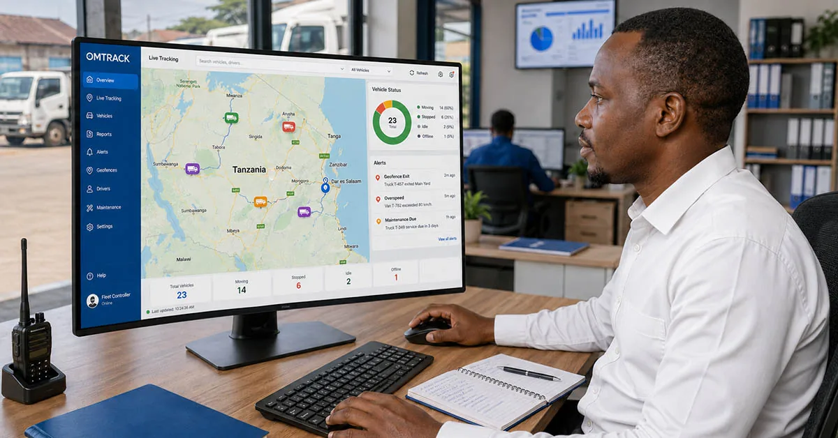
GPS vehicle tracking helps you know where your vehicles are and how they are being used.
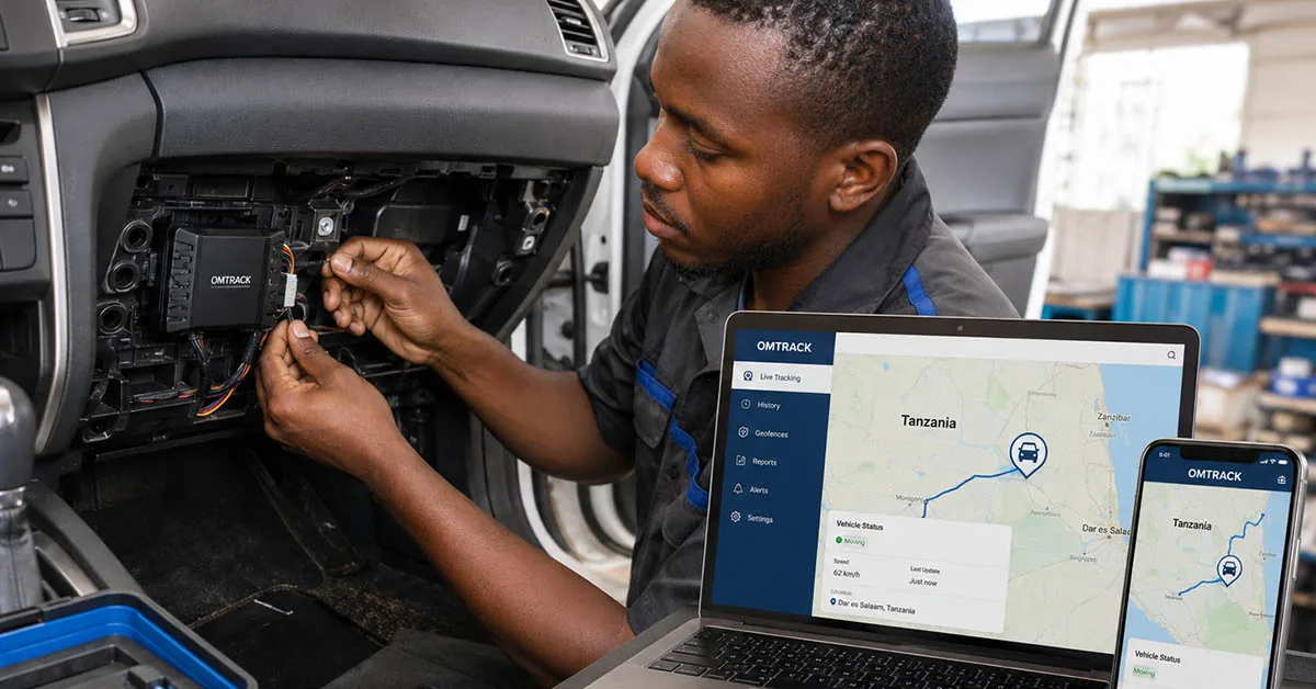
A small GPS device is professionally installed in each vehicle. The device receives location information from satellites and normally sends that information to the tracking platform through a mobile network.
You can then log in from your phone or computer to view the latest reported vehicle location on a digital map.
Depending on your selected device and service package, you may also be able to check:
Practical applications
GPS vehicle tracking can be used by any business that owns or manages vehicles. It gives managers clearer information about vehicle locations, trips, drivers and daily operations.
Here are some of its general applications.
Managers can view the latest reported location of every connected vehicle on a digital map.
They can quickly identify which vehicles are moving, stopped, idle or offline without repeatedly calling drivers.
The system keeps a record of previous vehicle movements.
Managers can review:
This information can help answer questions about delays, completed trips and vehicle usage.
Dispatchers can use current vehicle locations to plan new assignments.
They can choose a nearby available vehicle, reduce unnecessary travel and monitor whether drivers are following the planned routes.
GPS tracking can record events related to how vehicles are being used.
Depending on the selected features, managers may monitor:
This information can support driver training, accountability and safer driving.
When compatible fuel sensors are installed, the system may provide information about fuel levels, refuelling and consumption.
Managers can use this information to investigate:
Fuel information should always be reviewed together with trip records, receipts and vehicle condition.
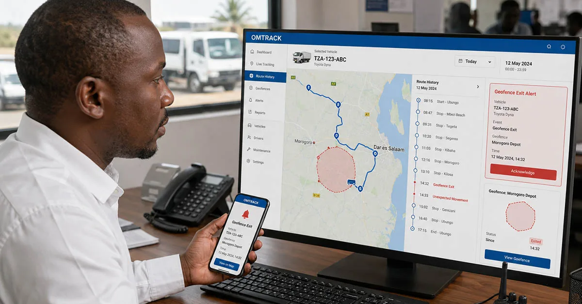
Geofencing allows the company to create virtual boundaries around approved operating areas.
The system can send an alert when a vehicle enters or leaves one of these areas.
This is useful for monitoring vehicle arrivals, departures and unauthorised movement.
Managers can set speed limits and receive alerts when a vehicle exceeds them.
Speed monitoring can support safer driving, reduce unnecessary fuel use and help protect vehicles, passengers and cargo.
GPS tracking can notify authorised users when a vehicle moves unexpectedly or leaves a defined area.
The location information may also help the company and relevant authorities respond when a vehicle is stolen.
Some compatible devices may support remote engine immobilisation. This feature must be used carefully and according to proper safety procedures.
The system can provide reminders based on mileage, engine hours or scheduled service dates.
Maintenance reminders may cover:
This can help reduce unexpected breakdowns and keep vehicles ready for work.
GPS tracking data can be turned into daily, weekly or monthly reports.
Reports may include:
These reports help managers understand how vehicles are being used and identify areas that may need improvement.
When customers ask about a delivery or service vehicle, the operations team can check its progress before responding.
This helps the company provide faster and more accurate updates.
GPS vehicle tracking brings important information into one platform.
Managers can use current locations, alerts, trip history and reports to make decisions based on available information instead of assumptions.
Omtrack Solution provides GPS vehicle tracking and fleet-management tools for businesses across Tanzania.
Practical capabilities
Use live location tracking to improve visibility, coordination and review within the relevant operation.
Use route history to improve visibility, coordination and review within the relevant operation.
Use geofencing to improve visibility, coordination and review within the relevant operation.
Use movement alerts to improve visibility, coordination and review within the relevant operation.
Use speed alerts to improve visibility, coordination and review within the relevant operation.
Use mobile access to improve visibility, coordination and review within the relevant operation.
How it works
GPS vehicle tracking works by connecting a tracking device installed in your vehicle to the Omtrack online platform.
The process is simple:
A compatible GPS device is professionally installed inside each vehicle.
The device is connected to the vehicle and configured to communicate with the Omtrack platform. Depending on the selected solution, additional sensors may be installed to monitor fuel, ignition, doors or other vehicle information.
The installed tracking device uses signals from GPS satellites to determine the vehicle’s location.
It may also collect other available information, including:
The exact information available depends on the installed device, vehicle and selected service package.
The tracking device normally uses a mobile data network to send vehicle information to the Omtrack platform.
When the vehicle travels through an area with weak or unavailable mobile coverage, updates may be delayed. A compatible device may store some information and send it when network connectivity becomes available again.
Authorised users can log in to Omtrack from a computer, tablet or mobile phone.
The live map shows the latest reported location and status of every connected vehicle.
Managers can quickly check:
You can choose which events should trigger notifications.
Depending on the selected features, alerts may include:
Alerts help your team notice unusual activity without watching the map throughout the day.
Omtrack keeps available vehicle information for later review.
Authorised users can check trip history, routes travelled, stop durations, distances and other recorded activity.
Reports can help your company understand how vehicles are being used, investigate delays, support drivers and plan future operations.
The final step is turning the available information into action.
Your company can use Omtrack to:
Omtrack does not replace your managers or drivers. It gives them clearer information so they can work together more effectively.
Install. Connect. Track and manage—all through one Omtrack platform.
Local understanding
Omtrack combines GPS tracking with practical fleet and logistics tools for private vehicle owners and organisations that need reliable visibility of cars, vans, buses or trucks.
It is designed around the way businesses operate in Tanzania, including different vehicle types, mobile access and the need to speak with a local support team when help is needed.
You can start with the features that matter now and add more as your operation grows.
We want the system to feel useful, not technical for the sake of it.
Professional installation, a clear dashboard and guided onboarding help your team get comfortable with the platform.
Software cannot fix every business challenge on its own, but the right information can make supervision, planning and customer updates much easier.
A practical example
A business owner can confirm that a vehicle has reached its assigned destination, review the route taken and receive an alert when it moves outside an approved area.
If something looks unusual, the office can check the related alert or trip history before calling the driver.
That means the conversation starts with useful context instead of guesswork.
Managers still use their experience, and drivers still carry responsibility, but everyone works from a clearer picture.
Customer perspective
 TBS
TBS LATRA
LATRA Tanzania Police
 TRA
TRA SUMATRA
 WMA
WMAHelpful answers
It is a good fit for private vehicle owners and organisations that need reliable visibility of cars, vans, buses or trucks. Your best setup will depend on how many vehicles you have, where they travel and what your team wants to improve. During a demo, we can talk through those needs and show you the most relevant features.
Yes, mobile access is an important part of the Omtrack experience. Authorised users can check relevant vehicle information and alerts while away from the office. The exact tools you can access will depend on your package and the permissions given to each user.
Yes. Omtrack can support a small fleet and grow with you. Your starting setup should match the number and type of vehicles you have, the alerts you need and whether you also want tools such as fuel monitoring, driver monitoring or dispatch management.
Reports can show vehicle movement, trips, stops, alerts and other information recorded by your chosen setup. The details depend on the devices and software features included. During a demo, we can show you the reports that make the most sense for your operation.
Request a demo or quotation and tell us how many vehicles you have, the vehicle types, where you operate and which features matter to you. Omtrack can then suggest a suitable setup and explain the device, installation, software and support costs clearly.
A clearer fleet starts here
Want to see how GPS vehicle tracking Tanzania could work for your business? Book a personalised Omtrack demo. We will look at your vehicles, your daily workflow and the features that matter most to you. You can also contact the Omtrack team by phone or email using the details provided on this website.